
The Einstein Path
Genoa and surroundings
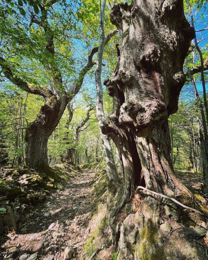
Walk in the footsteps of Albert Einstein, who in 1895, at the age of 16, crossed the Antola Park. When he was a young student, Einstein moved to Pavia from Munich to stay with his father Herman for a while. During his stay, he decided to visit Genoa, where his maternal uncle Jacob Koch lived, because he wanted to see the sea. He packed his suitcase, took his books and a map and, with his friend Otto Neustatter, sets off along the route that in the Middle Ages was known as the salt route and continued through what is now the Antola Park. Therefore, the Einstein Path was named after restless, leggy 16-year-old Albert Einstein, who crossed the Apennines on foot. He recounted his experience much later, when he had already become famous, always remembering his youth fondly. Today, after much research, it has been discovered that the route taken by young Albert through the park is some 48 kilometres long, through the green Trebbia Valley, in the municipalities of Fascia, Rondanina, Montebruno and Propata. The Antola Regional Park has restored that path, with signposts and viewpoints, naming it the “Einstein Path”.
Fascia
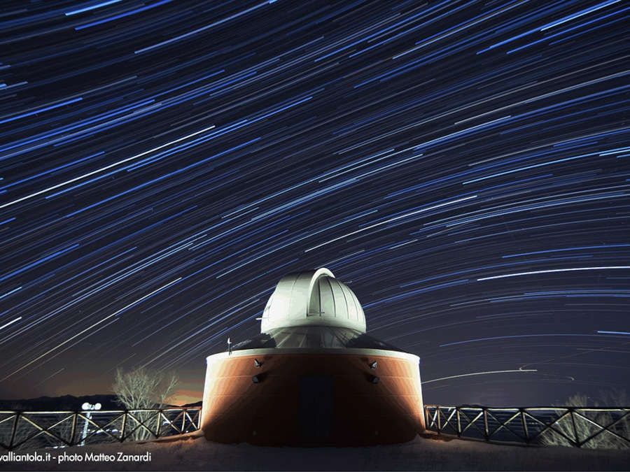
It is at the top of the Genoa area, in the municipality of Fascia, which is the highest in Liguria, at 1,118 metres, exactly where the borders of Liguria, Piedmont, Emilia and Lombardy meet. In addition to the height record, Fascia also boasts that of being one of the smallest municipalities in the region, with only 120 inhabitants, who return mainly in the summer, and it was also an active centre during the Resistance, as well as the ‘home of ravioli’. The church of San Rocco is worth a visit. We also recommend a visit to the village's only trattoria to taste ravioli with mushroom sauce. Since 2010, Fascia has housed the largest Astronomical Observatory in the region. What if that big dark sky had inspired the young Einstein? The Astronomical Observatory is open almost all year round and has special features that make it ideal for observing the sky.
Rondanina
Another mountain village in an open, panoramic position. It overlooks both the valley of the Cassingheno stream and the Bric di Rondanina (a 1,340 metres high peak at about two hours' walk from the refuge). The ground floor of the Town Hall building houses the Park Flora and Fauna Museum and the small municipal library. It borders with the parish church of San Nicola di Bari, the oldest in the Trebbia Valley. The area also overlooks Lake Brugneto, an artificial reservoir along whose shores a beautiful path is traced.
Montebruno
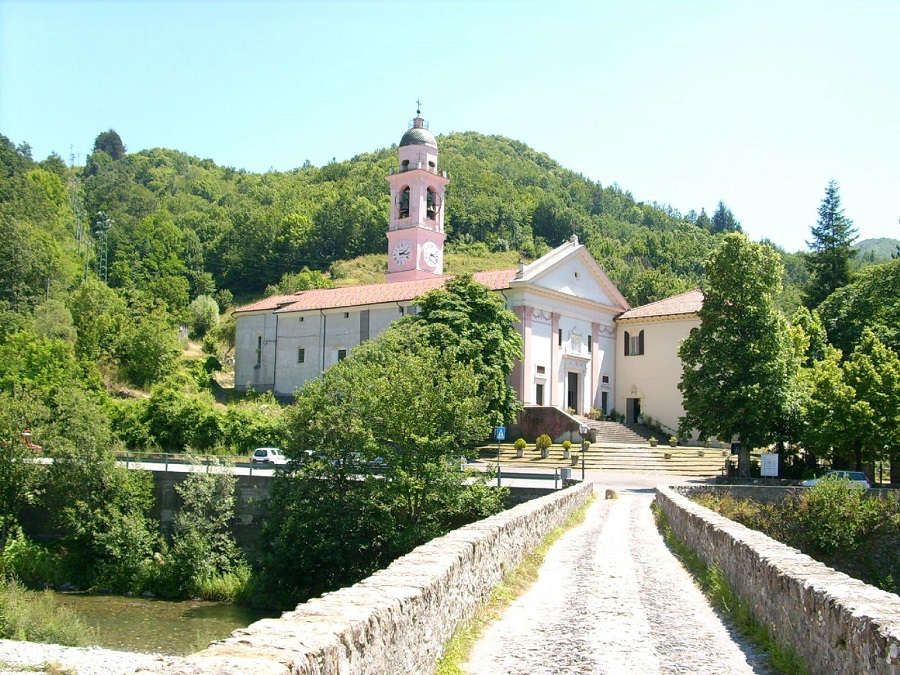
It is one of the richest villages in the valley in terms of history and culture. Here you will find the famous and beautiful Sanctuary, bordering with the Farmers' Museum. The interior of the church is divided into three naves and the Gothic-style architectural structure of its ogival arches allow to date it back to the 15th or 16th century. The large polychrome marble high altar is Baroque and beautiful. And who knows whether the young Einstein crossed the beautiful stone bridge over the course of the Trebbia. In the village, there are many small shops, including the famous ‘da Carlo’ bakery, which is a must for gourmets.
Propata
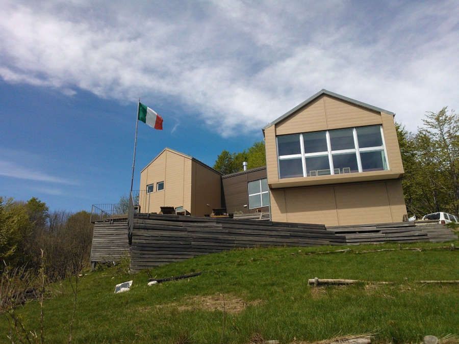
From Propata, you can enjoy several excursions to Lake Brugneto or to Mount Antola in a beautiful natural environment. The parish church of San Lorenzo, dating back to the Baroque period, is worth a visit. Inside it, you will find a wooden choir from the late 17th century and a statue attributed to Maragliano. This is also where the Rifugio dell'Antola is located, at 1,460 metres above sea level, with a splendid view of the valley below. The refuge, owned by the Park, is managed by the Ligurian Section of the Italian Alpine Club and is open in spring, summer and autumn. It provides support for tourists, and it is also a base for the Park's scientific and environmental surveillance and education activities.


